Dyoondalup Bike Park
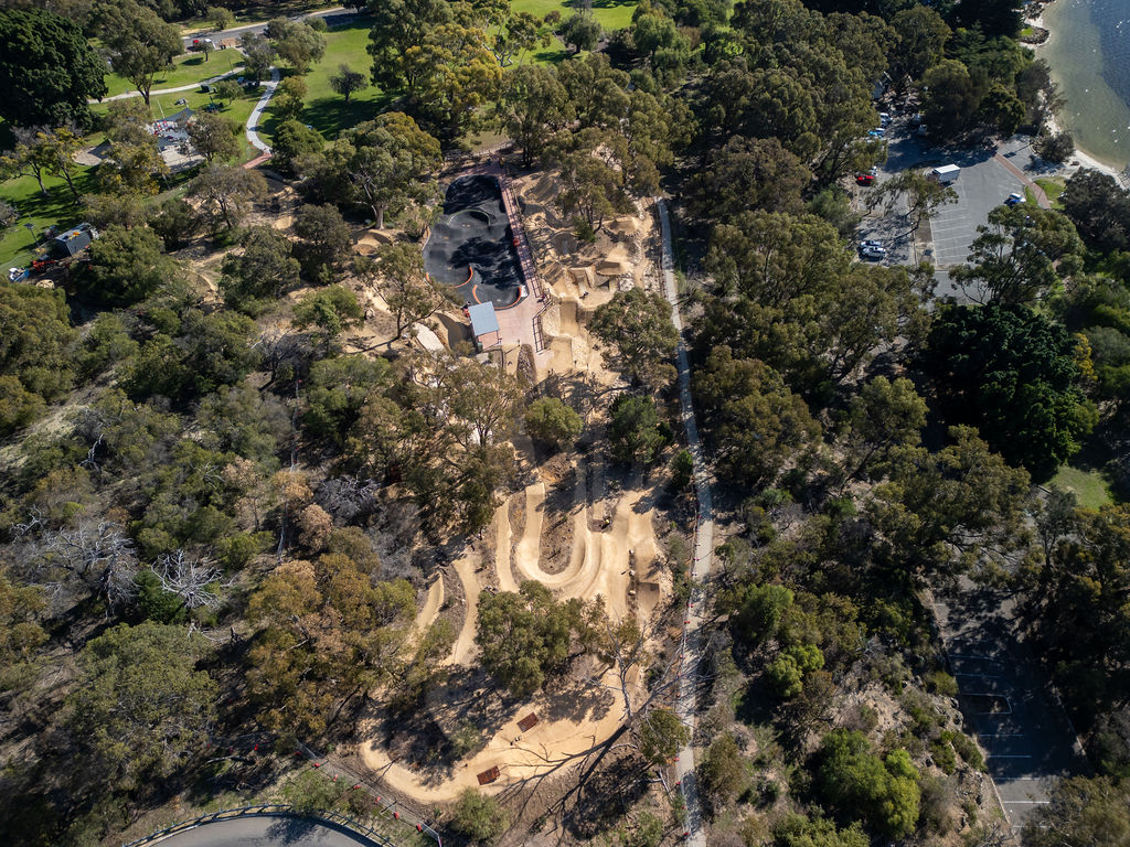
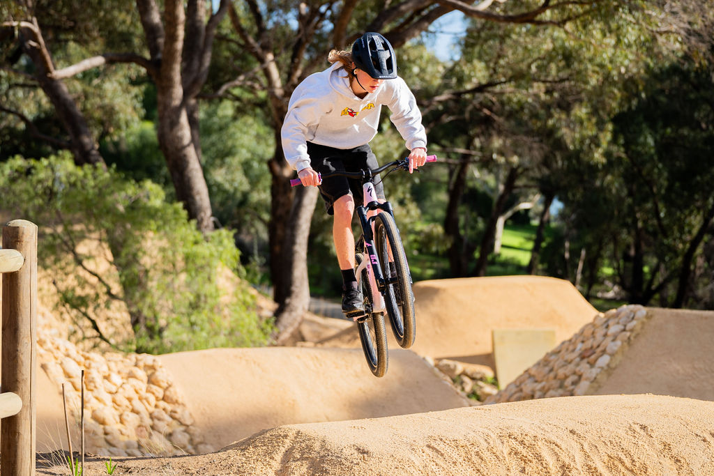
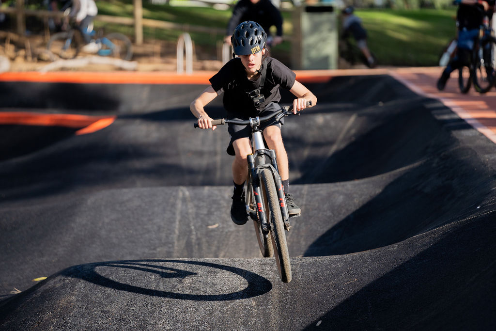
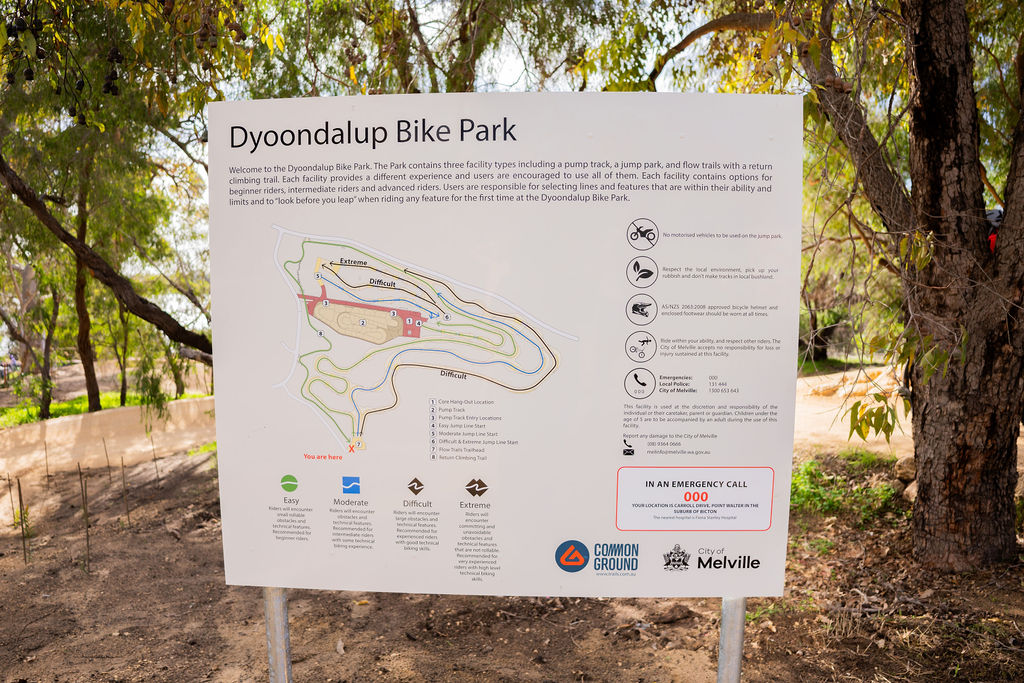
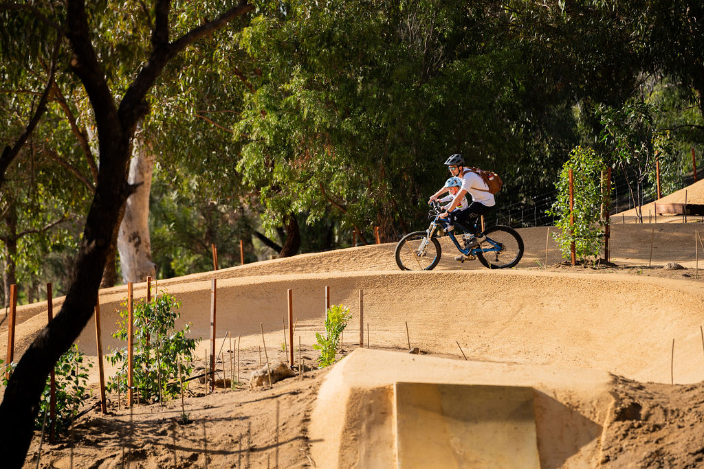
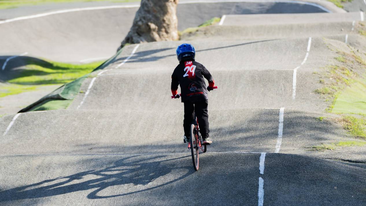
The Dyoondalup Bike Park at Point Walter Reserve provides a dedicated space for local riders of all experience levels to enjoy. The facility includes three flow trails, a jump park and pump track to cater for a diverse range of biking, with green, blue and black-coded trails for differing skill levels.
This bike park is designed to develop, encourage and grow people’s confidence in riding, offering a wonderful nature riding experience in an urban setting.
The City greatly acknowledges the $1.48M contribution made by the Federal Government and the Member for Tangney through their Local Roads and Community Infrastructure Program, that has made this amazing facility a reality.
The park includes considerable signage to highlight that riders should ride within their ability and only progress to more advanced stages only when they are adequately competent at the lower levels, and on bikes that are appropriately built and maintained for these necessary features.
This facility is used at the discretion and responsibility of the individual or their caretaker, parent or guardian. Children under the age of 5 are to be accompanied by an adult at all times during the use of this facility.
In case of an emergency, riders are encouraged to call 000, noting that the location of the park is Carroll Drive, Point Walter in the suburb of Bicton. The nearest hospital to the site is Fiona Stanley Hospital.
The majority of the flow trails, pump track, and jump lines at the park cater for progression; and are heavily weighted to the beginner and/or intermediate riders. There are also a small portion of advanced level features.
The map at the bike park outlines the easy, moderate, difficult and extreme level trails.
Although not all established trees could be preserved due to the park's layout, the site's original landscape was maintained to the greatest extent possible.
To compensate for the necessary removal of some trees, a substantial replanting initiative was undertaken, with thousands of individual plants including over 200 trees being introduced to the area.
Furthermore, the natural areas team has plans to plant many more native species in the coming years to further enhance the environmental and biodiversity values of this precious woodland site.
Throughout the project, the City worked closely with Whadjuk representatives, who supported the construction of the bike park, to understand the cultural significance of the site and ensure all plans respected this.
Check out the Your Move map, which includes walking, cycling and public transport routes.
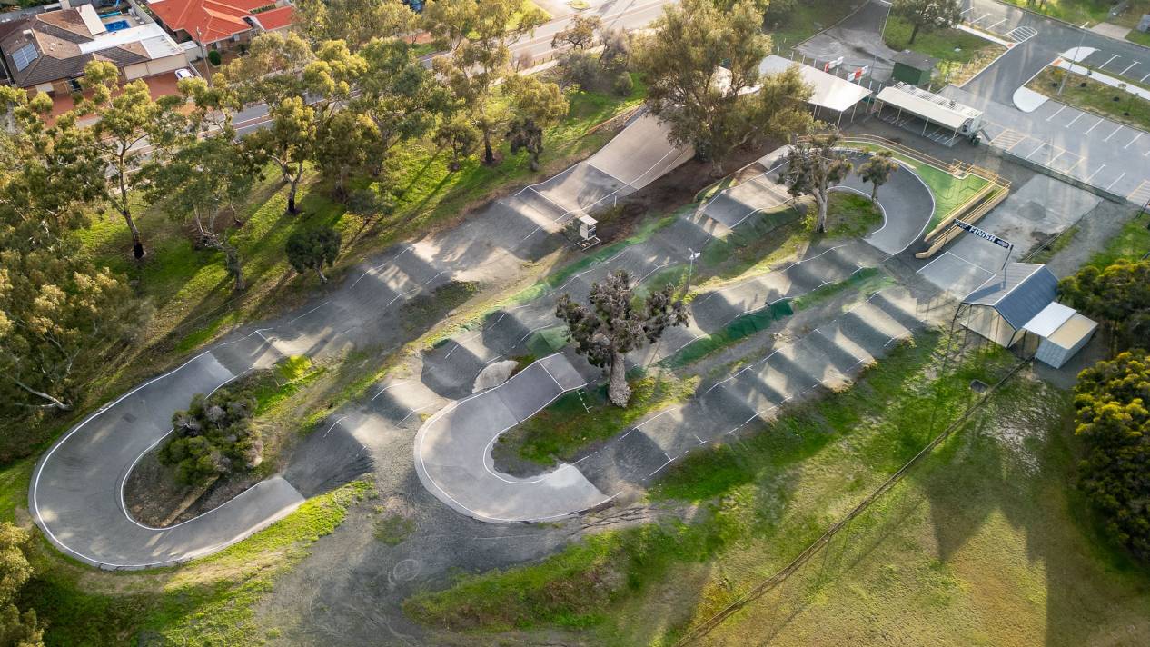
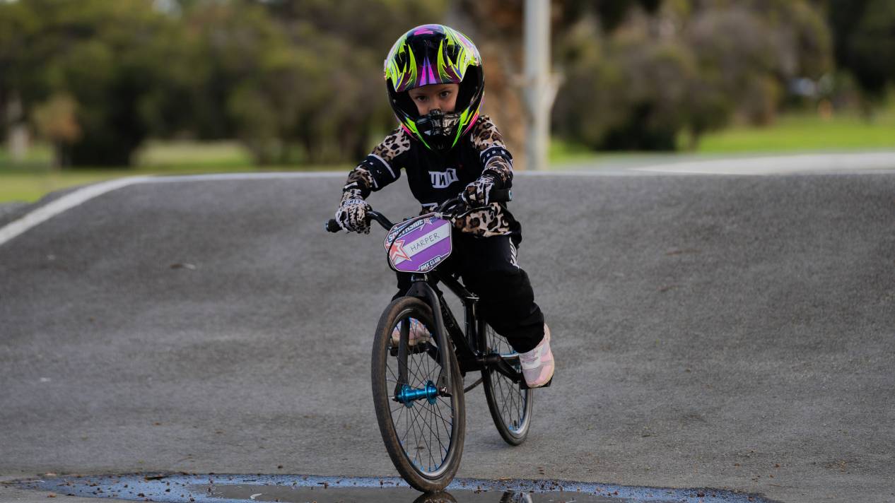
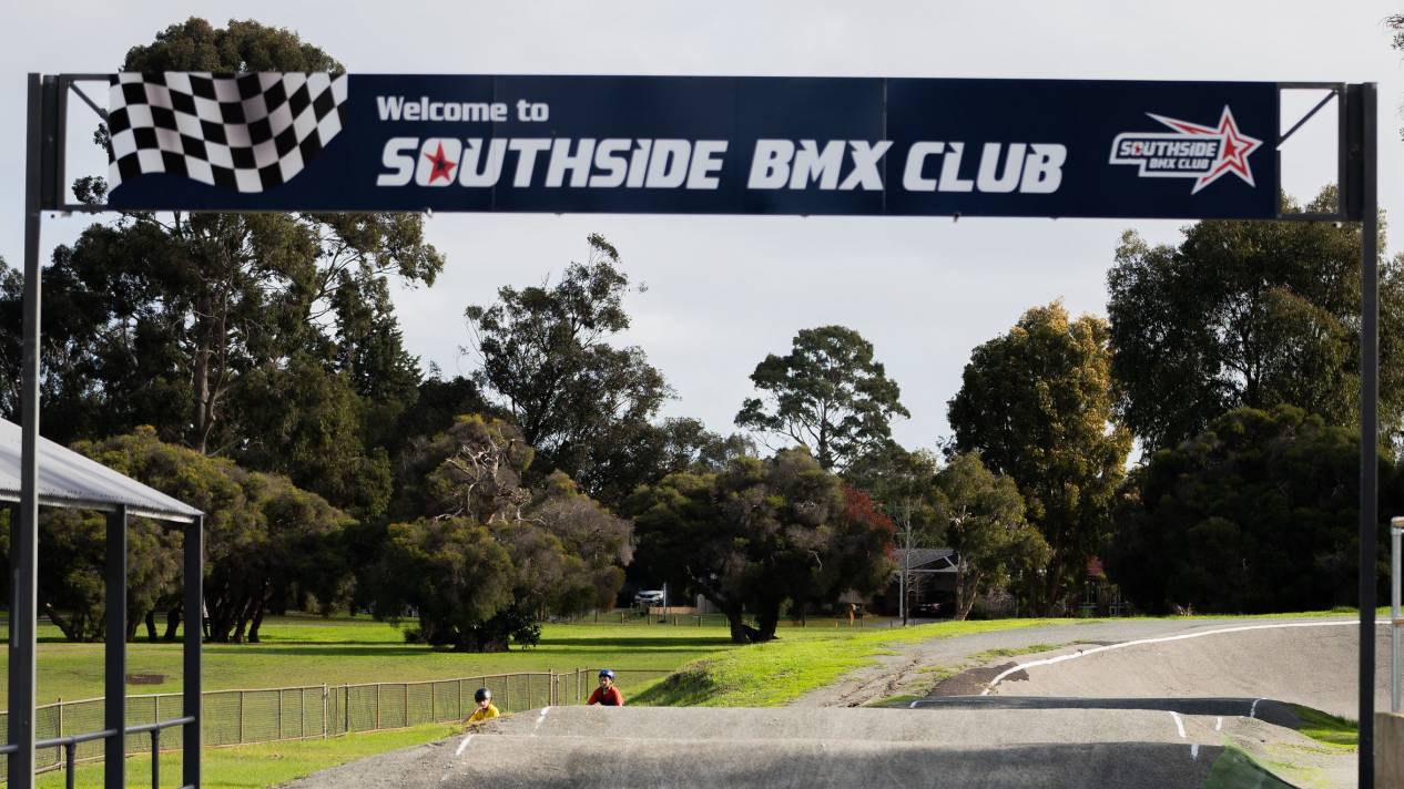
Southside BMX Track
DIY Jumps
Following passionate advocacy from local kids and families for additional biking infrastructure in the City of Melville, the City has authorised DIY bike jumps at John Creaney Reserve, Morris Buzacott Reserve and Shirley Strickland Reserve.
Rolling Forward – Our Wheeled Sports Plan provides strategic guidance for the planning, development, management and maintenance of wheeled sports facilities (including Mountain Biking & BMX, amongst others) in the City of Melville.
A strategy for wheeled sports facilities in the City of Melville has not previously existed which has led to an inequitable distribution, poor function and limited diversity in existing facilities to service the needs of our community.
The adoption of Rolling Forward - Our Wheeled Sports Plan will ensure our future wheeled sports facilities are functional, diverse, sustainable and accessible.